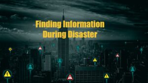
Gathering information during a disaster can be crucial for survival and for relief efforts. The news may not cover everything you need to know. Having your own accurate disaster assessment is one of the most essential parts of disaster response and preparedness.
Disaster response is all about sending the right resources to the right location in a timely manner.
Disaster preparedness is all about knowing how to be prepared for disasters that may come.
How to use social media to assess disaster damage
Social media is a treasure trove of information on disasters if you know how to wade through it. By spending a few moments searching for disaster related events on social media, you can quickly gather a broad assessment of the situation.
Be on the lookout for a social media blackout. Did a big event just happen, but no one is posting about it? The event could have disrupted communications and is a sign of a serious event. When telecommunication goes down, it becomes much more difficult to gather an accurate assessment of the area.
When disaster strikes, Twitter will be the first to know. Their stories often trend hours ahead of media coverage. If you’re lucky, you’ll have hundreds of photos and videos to see what type of damage has occurred.
You can view posts by hashtags, #fire #hurricane #explosion
Facebook gives you easy access to local official channels, storm spotters, and sometimes citizens giving live updates on storm conditions. This makes for a convenient way to watch live weather reports during severe weather.
Images of damage can quickly go viral. Local news stations often ask their audience to post storm damage pictures in their comments section.
Community support groups pop up rapidly after a disaster. They can be difficult to locate. Some humanitarian and storm chaser pages on Facebook will share them. They’re often called something similar to “Houston Recovery Network” or “Joplin Strong”.
Snapchat
Yup, that’s right! Snapchat. This is my favorite, nontraditional way to assess a disaster. Snapchat has an option to share short videos or photos publicly. Best of all, they overlay these videos on a map. This gives you an easy way to search a geographical area.
The information on Snapchat won’t be from the most reliable crowd, but I’ve still found it helpful. Every other video will be someone smoking marijuana, but the next video could be a video of the wind, the number of emergency vehicles at an event, or an “amateur forecaster” giving a forecast in the middle of a hurricane. These “amateur forecasters” often ham up the reports, so use your wisdom, but give it a shot if you aren’t finding what you need elsewhere.
Snapchat works best either during widespread events or in densely populated areas.
New social media
As the digital landscape develops, more social media channels compete for the lead. Any new platform may end up being the best new place to find information during a disaster.
Twitch and YouTube can show live feeds often showing storm chases or protests.
How can I help first responders and organizations during a disaster?
If you have been in a large natural disaster or event, sharing updates and images can be extremely helpful! Do not endanger yourself or others, though.
Sharing information during a disaster on social media:
If you are in distress during a disaster,
- Send your exact location; drop a pin, and screenshot your gps location.
- State how many people need help.
- Mention critical needs (water, food, medical)
- Estimated priority level (how many hours will you be safe?)
Sharing general information about a disaster
- Location
- Damage report
- Number of affected individuals
- Power, food, and water status
- Roads blocked
- Photos/videos of damage (show the whole yard or street when taking photos)
- Drone footage (Ensure the area has not been restricted for drones. Do not use a drone during emergency air operations.)
News and communication options during a disaster
News stations are a great resource for finding information on disasters. That said, most news stations’ primary aim is to make money, and to do that they need viewers and clicks. This means damage can often be exaggerated, or sometimes they find a simple spot to do their story and don’t get views of the worst damage.
A few years ago, Florida was on alert for a hurricane off the coast. The storm’s path changed. It became apparent that the storm would not make landfall in Florida or cause any damage. Instead of calling it a day, the reporters moved further out into the waves on the beach to make the storm appear more intimidating. They were reporting on the “terrible” storm conditions while standing in the ocean.
Now you know why I like the amateur reporters on Snapchat!
For larger events, BBC provides some of the best and least biased news coverage available. Their US coverage is not very extensive, but they do a great job covering most global events and humanitarian issues.
Local radio stations & Radio Garden
Local radio stations can be a treasure trove of information specific to their location. Listeners will call in with tips and information about community resources.
Radio Garden is an interactive website that displays radio stations as points on a world map. When you hover over the area, hundreds of local radio stations will populate. You can select a station and listen to their stream instantly. The geolocation feature can promptly find the closest radio station to the disaster.
Ham radio use during disasters
Ham radio, or amateur radio, is the oldest form of communication we have listed on here.
Communication through ham radio requires two things: a radio to transmit, and a way to receive the message. With just a few items, you can send voice or data many miles. Ham radio can be as simple or advanced as you want to make it. Ham radio is reliable to its core. It remains one of the simplest communication fall backs, despite operating on technology that has existed in some form for over 100 years now.
You can monitor traffic on “nets” to get real time reports of storm damage from storm spotters. These “nets” are a structured group of ham radio operators gathering and relaying information during a disaster.
The best thing about ham radio is its resilience. Even if all other forms of communication fail, ham radio will still operate.
To get your ham license as easily as possible, see our article.
Satellite phone
Next to ham radio, satellite phone operators will be one of the few people able to communicate during a large disaster. Take, for example, the large underwater volcano eruption near Tonga. The eruption severed their only communication. It was days before anyone heard from them. All the news organizations were relying on reports from one guy with a satellite phone.
Additional resources to find information during a disaster
Apps for disaster response
Police scanner and earthquake apps can send you real-time alerts when disasters happen.
Websites for disaster response

The internet has a lot of useful content; unfortunately, it’s often broken up across many sites. That’s why we made the Disaster Dashboard. It provides severe weather outlooks, storm warnings, satellite images, and more all in one spot. Make sure you bookmark it so you can find it again.
The Disaster Dashboard provides a full country overview in seconds, all on one page. We designed it to be a huge timesaver for anyone involved in disaster relief and disaster management. All are welcome to use it!
Poweroutage.us can visualize the effects a storm has on the power grid. You can see the general path of severe weather by watching the power outages on their maps. Clicking on the individual state will give you a breakdown of how much of each county is being affected by the storms.
You’ll want to get gas and food several counties ahead of the outages when driving into a disaster. Evacuations and disasters cause food and fuel resources to be low or nonexistent, even outside the main area of destruction. By eating and fueling up miles away from the disaster, you won’t be depleting critical resources nearby.
Down Detector is a site that reports offline websites. When Facebook crashes, users report it here. During a disaster, many services can be interrupted. If a storm affects a server for a particular website or app, people can report the outage on their site.
Mostly, it comes in handy when you’re trying to figure out if a website is down or if it’s just you.
Factors that alter the distribution of disaster information
Getting information about disasters can be slow. Several criteria affect how much information can get out.
Communication access
For people to know the extent of a disaster, someone has to inform them. When communication channels are down, the true extent of the damage can’t be shared.
The harder a particular area is hit, the less information will make it to social media or news networks. Often you’ll get video and photos of the initial impact, then hear nothing for hours or days while critical infrastructure is repaired and eventually comes back online.
Time of day
It’s very difficult to gauge damage in the dark. News channels will broadcast in front of the damage and then call it a night at 10 pm. News articles aren’t updated frequently overnight. The extent of damage from a hurricane, tornado, and most other disasters is difficult to capture in complete darkness. To get a clear view of the damage, you’ll have to wait for daylight.
Outside observation
The easiest disasters to find information on are disasters that were viewed at a distance. Examples of this would be 9-11, the 2020 Beirut explosion, and wildfires.
If a large crowd had a good view of the incident, images and video will quickly flood the internet. These events are fairly localized, so communication services are still operational.
Disaster relief
We can use technology as a powerful source to gather information during a disaster. Better information can help us make more educated decisions as we respond to disasters.
Join our email to hear about new resources to help you stay on top of severe weather outbreaks
- Disaster Relief Needs X (You should use it too)

- Faith in Action: Responding to Trump’s Reduction in Humanitarian Aid

- How to Help Someone Who is on Fire
- How To Get Help When 9-1-1 Is Down

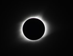
- Does a Solar Eclipse Really Warrant a State of Emergency?
- The Coming Digital Apocalypse?

- Disaster Survival: Do These 3 Things Within 60 Seconds
- 5 Disaster Relief Tips for a Major Earthquake Response
- Can We Shoot the Chinese Balloon Down?
- Incident Management Team: Tips for a Successful Deployment
- TC001 Best New Thermal Camera? Review for TOPDON TCView
- 5 Ways To Stop Overpaying For Healthcare