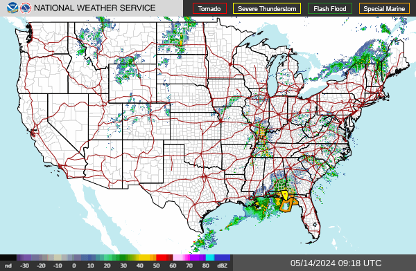
Our Weather Gauges track warnings in real-time. By clicking on the affected areas listed beneath each gauge, you can access a variety of sources for more information, including Google Maps, Facebook, and Twitter.
On a desktop you can hover over the counties for the warning information.
By default the links will take you to our Red Sky Ready page for that county with local radar, forecast, warnings, and the local NWS Twitter feed. If you have any suggestions or problems let us know! Some features like the Facebook and Twitter searches may become a premium feature in the future.